 Catàleg local de Mallorca
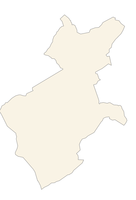
Ajuntament d'Alaró
Type of resources
Available actions
Municipios
INSPIRE themes
Keywords
Contact for the resource
Provided by
Years
Formats
Representation types
Service types
Scale
-
Web Map Service that allows access to the cartography of the names of Land use, Protected Sites and Transport Network. The service contains a single layer with the texts extracted from the layers of Land use, Protected Sites and Transport Network. You can also check the characteristics of the texts. The associated style of layers is defined by the INSPIRE specifications. Access to this service is free provided that Alaró Town Hall appears as the owner of the data and Consell de Mallorca as the owner of the service.
-
Web Map Service that allows you to access maps of the elements of sites protected by municipal regulations. The service contains the general layer called Protected. Sites where there are all protected elements, and also several layers according to the classification of protection, the Designation and the Designation Scheme. The symbolism associated with layers is defined by the INSPIRE specifications. Access to this service is free provided that the Council of Alaró appears as the owner of the data and Consell de Mallorca as the owner of the service. The protected areas of the urban zones are at 1: 1,000 scale and the elements of rustic areas are at 1: 5,000 scale.
-
Cartography of the Utility And Governmental Services of the municipality of Alaró. Reference system: ETRS89. Projection system: UTM fus 31. Storage format: PostgreSQL
-
ATOM download service that allows access to the cartography of addresses, transport infrastructure network, land use, protected sites, management areas, utilities and governmental services and geographical names of the municipality of Alaró. Cartography extracted from the Cartociudad project. The service complies with the INSPIRE download services technical guide (version 3.1) and uses OpenSearch technology to query the available data sets. The phenomena are served according to the original data model of each project. Access to this service is free provided that Alaró Town Hall appears as the owner of the data and Consell de Mallorca as the owner of the service. Scale 1: 2,000.
-
Data set containing the addresses of the urban center of Alaró and a few kilometers from the rustic area of the municipality. Cartography was extracted from the Cartociudad project of 2012, a state project that collects all spatial information related to directions and roads. The AD.Addresses layer is a layer of points and contains the addresses or portal numbers and various attributes that follow the Cartociudad data model and INSPIRE. Scale 1: 2,000. The reference system: ETRS89. Projection system: UTM fus 31. Storage format: PostgreSQL.
-

Dataset containing public facilities and heritage buildings in Alaro. The cartography was extracted from a 2003 Alaro municipal information layer. The Buildings layer is a polygon layer and contains the buildings on rural land that follow the INSPIRE data model. Scale 1: 5,000. The reference system: ETRS89. Projection system: UTM zone 31. Storage format: PostgreSQL.
-
Web Map Service that allows access to the cartography of the addresses of the municipality of Alaró. Cartography extracted from the Cartociudad project. The service contains the general layer called AD.Addresses.001 contains the addresses of the urban center of Alaró and a few kilometers from the rustic area of the municipality. The symbolism associated with layers is defined by the INSPIRE specifications. Access to this service is free provided that Alaró Town Hall appears as the owner of the data and Consell de Mallorca as the owner of the service. Scale 1: 2,000.
-
Web Map Service according to the INSPIRE profile of ISO19128 WMS 1.3.0 that allows access to the cartography that represents the transport infrastructure network of Alaró, Mallorca, Balearic Islands Spain. The scale of representation is 1: 5000. Geographic information belonging to the Inspire annex is shown: 1) Transport networks. The layers of information are in accordance with the INSPIRE Directive 2007/2 / EC (name, title and style Inspire by default). The access or connection to this service, to obtain the functionalities is free in any case.
-
Data set containing the management areas of the municipality of Alaro. The cartography was taken from the Alaro Subsidiary Standards of 2003. The AM.ForestManagementArea and AM.ProspectingAndMiningPermitArea layers are polygons layers and contains managed, restricted, or regulated forest areas that follow the INSPIRE data model. Scale 1: 5,000. The reference system: ETRS89. Projection system: UTM zone 31. Storage format: PostgreSQL.
-
Cartography of the network of roads, roads and streets of the municipality of Alaró. It refers to the topic Transportation Networks in Annex I of the INSPIRE Directive. Mapping generated in 2016. The sources are the Catalog of roads of 1997, prepared by the Consell de Mallorca in DGN format, and the streets of the Cadastre. Scale 1: 2,000 the streets and scale 1: 5,000 the roads and roads. Reference system: ETRS89. Projection system: UTM fus 31. Storage format: PostgreSQL.