 Catàleg local de Mallorca
2021
Type of resources
Available actions
Municipios
INSPIRE themes
Keywords
Contact for the resource
Provided by
Years
Formats
Representation types
Service types
Scale
-
Web Map Service that allows access to the cartography of the addresses of the municipality of Lloseta. Cartography extracted from the Cartociudad project. The service contains the general layer called AD.Addresses.029 contains the addresses of the urban center of Lloseta and a few kilometers from the rustic area of the municipality. The symbolism associated with layers is defined by the INSPIRE specifications. Access to this service is free provided that Lloseta Town Hall appears as the owner of the data and Consell de Mallorca as the owner of the service. Scale 1: 2,000.
-
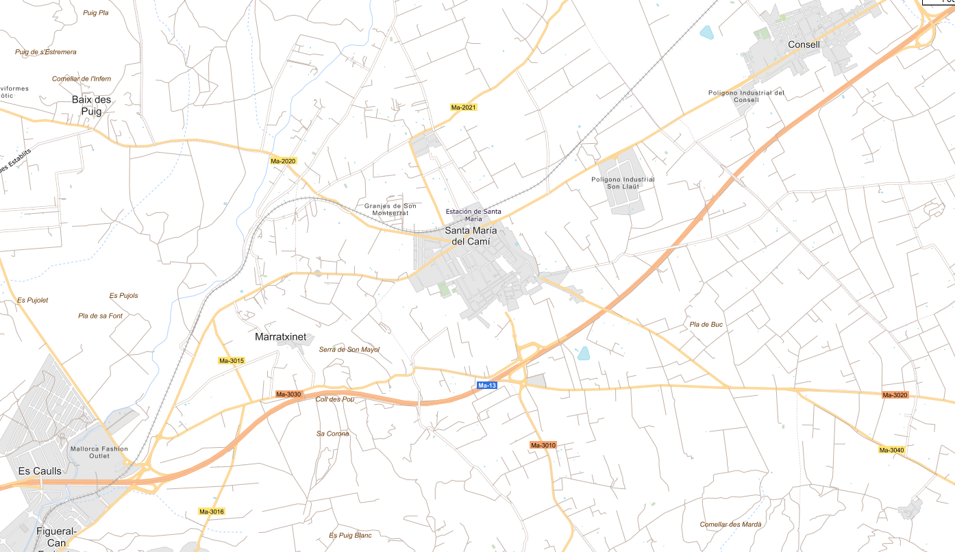
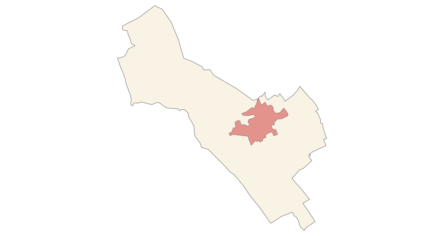
Web Map Service that allows access to the cartography of the names of Transport networks. You can also check the characteristics of the texts. The associated style of layers is defined by the INSPIRE specifications. Access to this service is free provided that Santa Maria del Camí Town Hall appears as the owner of the data and Consell de Mallorca as the owner of the service.
-

Web Map Service according to the INSPIRE profile of ISO19128 WMS 1.3.0 that allows access to the cartography that represents the transport infrastructure network of Sa Pobla, Mallorca, Balearic Islands Spain. The scale of representation is 1:5000 for the roads and 1:2000 for the streets. Geographic information belonging to the Inspire annex is shown: 1) Transport networks. The layers of information are in accordance with the INSPIRE Directive 2007/2/EC (name, title and style Inspire by default). The access or connection to this service, to obtain the functionalities is free in any case.
-
Web Map Service that allows access to the cartography of the buildings of the municipality of Calvià. Cartography extracted from a self-made layer of the municipality of Calvià from the 2009 Catalog of Heritage Assets. The service contains the general layer BU.Buildings contains the buildings of Calvià. The symbology associated with the layers is defined by the INSPIRE specifications. Access to this service is free as long as the Calvià City Council appears as the owner of the data and the Consell de Mallorca as the owner of the service. Scale 1: 5,000.
-
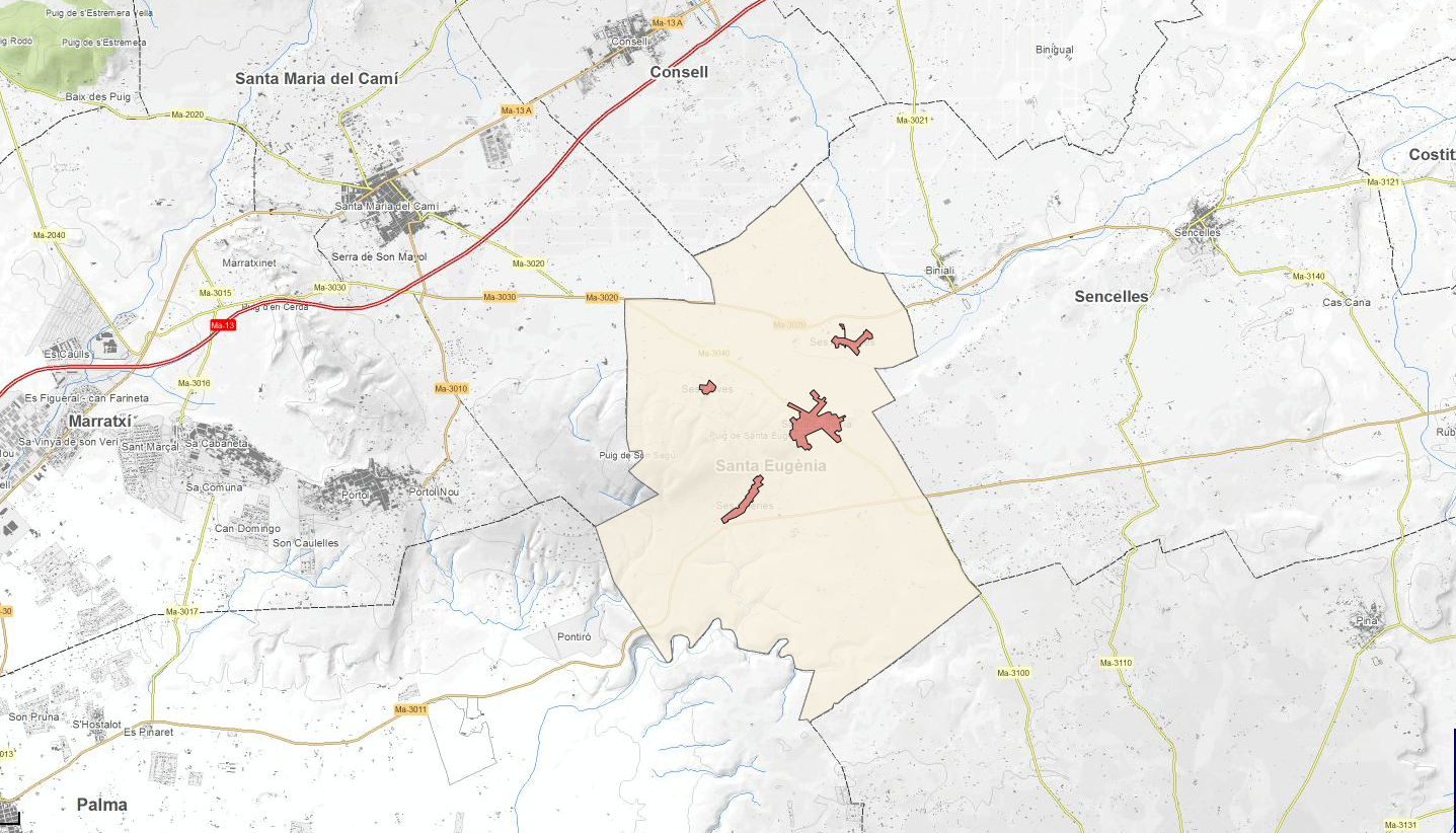
Download service ATOM that allows access to the cartography of transport infrastructure network, land use, protected sites and geographical names of the municipality of Santa Eugènia. The service complies with the INSPIRE download services technical guide (version 3.1) and uses OpenSearch technology to query the available data sets. The phenomena are served according to the original data model of each project. Access to this service is free provided that Santa Eugènia Town Hall appears as the owner of the data and Consell de Mallorca as the owner of the service. Scale 1: 2,000.
-
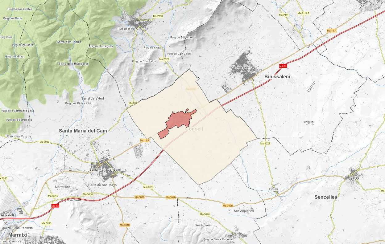
ATOM download service that allows access to the cartography of addresses, transport infrastructure network, land use, protected sites and geographical names of the municipality of Consell. Cartography extracted from the Cartociudad project. The service complies with the INSPIRE download services technical guide (version 3.1) and uses OpenSearch technology to query the available data sets. The phenomena are served according to the original data model of each project. Access to this service is free provided that Consell Town Hall appears as the owner of the data and Consell de Mallorca as the owner of the service. Scale 1: 2,000.
-
ATOM download service that allows access to the cartography of addresses, transport infrastructure network, land use, protected sites, management areas, buildings and geographical names of the municipality of Sa Pobla. Cartography extracted from the Cartociudad project. The service complies with the INSPIRE download services technical guide (version 3.1) and uses OpenSearch technology to query the available data sets. The phenomena are served according to the original data model of each project. Access to this service is free provided that Sa Pobla Town Hall appears as the owner of the data and Consell de Mallorca as the owner of the service. Scale 1: 2,000.
-
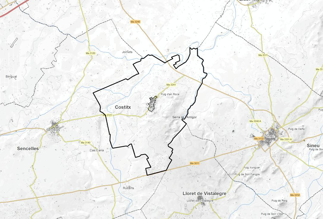
ATOM download service that allows access to the cartography of addresses, transport infrastructure network, land use, protected sites, buildings, management aresas and geographical names of the municipality of Costitx. The service complies with the INSPIRE download services technical guide (version 3.1) and uses OpenSearch technology to query the available data sets. The phenomena are served according to the original data model of each project. Access to this service is free provided that Costitx Town Hall appears as the owner of the data and Consell de Mallorca as the owner of the service. Scale 1: 2,000.
-
Cartography of the toponymy of the municipality of Santanyí. The names refer to the topics of the INSPIRE Transport Network and Protected Sites Directive in Annex I of the INSPIRE Directive and Land Uses in Annex III. Cartography generated in 2022. The sources are the Cartociudad project, version 2012, for the names of Transport, and the Consolidated Text of 2021 of Subsidiary Norms of 2007. The names of the urban elements are at scale 1: 2,000 and the names of the rustic elements, at a scale of 1: 5,000. Reference system: ETRS89. Projection system: UTM fus 31. Storage format: PostgreSQL.
-
Cartography of the toponymy of the municipality of Sa Pobla. The names refer to the topics of the INSPIRE Transport, Land Use and Protected Sites Directive in Annex I of the INSPIRE Directive and Land Uses in Annex III. Cartography generated in 2021. The sources are the Cartociudad project, version 2012, for the names of Transport, and the Urban Rules of 2002 and the Country Rules of 2003 for the names of Land Use and Protected Sites. The names of the urban elements are at scale 1: 2,000 and the names of the rustic elements, at a scale of 1: 5,000. Reference system: ETRS89. Projection system: UTM fus 31. Storage format: PostgreSQL.