 Catàleg local de Mallorca
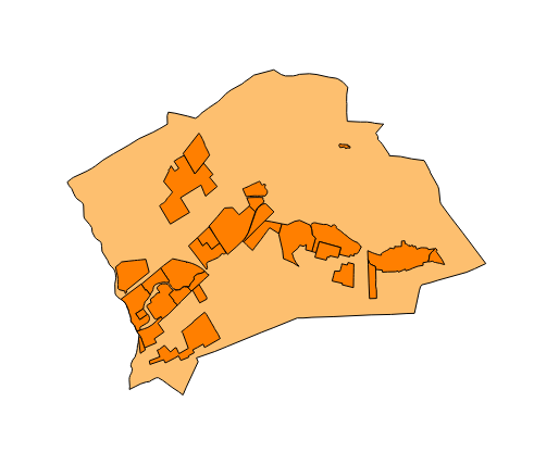
Ajuntament de Marratxí
Type of resources
Available actions
Municipios
INSPIRE themes
Keywords
Contact for the resource
Provided by
Years
Formats
Representation types
Service types
Scale
-
Web Map Service that allows access to the cartography of the Utility And Governmental Services of Marratxí. You can also check the characteristics of the layers. The associated style of layers is defined by the INSPIRE specifications. Access to this service is free provided that Marratxí Town Hall appears as the owner of the data and Consell de Mallorca as the owner of the service.
-
Web Map Service that allows access to the cartography of the names of Land Use, Protected Sites, Utility and Government services and Transport Network. The service contains a single layer with the texts extracted from the layers of Land Use, Protected Sites, Utlity and Government Services and Transport Network. You can also check the characteristics of the texts. The associated style of layers is defined by the INSPIRE specifications. Access to this service is free provided that Marratxí Town Hall appears as the owner of the data and Consell de Mallorca as the owner of the service.
-
Web map service that allows access to the cartography of the road inventory of the Catalog of roads in the municipality of Marratxí in 1998 which includes the ownership, status and typological aspects of the roads. The symbolism associated with the layers is defined by the Marratxí City Council. On the town hall website www.marratxi.es you can access all the cartography and files associated with this catalogue. Access to this service is free as long as Marratxí City Council appears as the owner of the data and Consell de Mallorca as the owner of the service.
-
Data set that contains the road inventory of the Catalog of roads in the municipality of Marratxí that includes the ownership, status and typological aspects of the roads. Scale 1: 5,000. The reference system: ETRS89. Projection system: UTM spindle 31. Storage format: GeopPackage and Postgis.
-
ATOM download service that allows access to the cartography of addresses, transport infrastructure network, land use, protected sites, managed areas, buildings and geographical names of the municipality of Marratxí. The service complies with the INSPIRE download services technical guide (version 3.1) and uses OpenSearch technology to query the available data sets. The phenomena are served according to the original data model of each project. Access to this service is free provided that Marratxí Town Hall appears as the owner of the data and Consell de Mallorca as the owner of the service. Scale 1: 2,000.
-
Web Map Service according to the INSPIRE profile of ISO19128 WMS 1.3.0 that allows access to the cartography that represents the transport infrastructure network of Marratxí, Mallorca, Balearic Islands Spain. The scale of representation is 1: 5000. Geographic information belonging to the Inspire annex I Transport networks. The layers of information are in accordance with the INSPIRE Directive 2007/2 / EC (name, title and style Inspire by default). The access or connection to this service, to obtain the functionalities is free in any case.
-
Web Map Service that allows you to access maps of the elements of sites protected by municipal regulations. The service contains the general layer called Protected. Sites where there are all protected elements. The symbolism associated with layers is defined by the INSPIRE specifications. Access to this service is free provided that the Council city of Marratxí appears as the owner of the data and Consell de Mallorca as the owner of the service. The protected areas of the urban zones are at 1: 1,000 scale and the elements of rustic areas are at 1: 5,000 scale.
-

Web Map Service that allows access to the cartography of the buildings of the municipality of Marratxí. Cartography extracted from a layer of equipment from the 1999 municipal regulations of the municipality of Marratxí. The service contains the general layer BU.Buildings contains the buildings of Marratxí. The symbology associated with the layers is defined by the INSPIRE specifications. Access to this service is free as long as the Marratxí City Council appears as the owner of the data and the Consell de Mallorca as the owner of the service. Scale 1: 5,000.
-
Map web service that allows access to the cartography of the Revision of the Subsidiary Rules of the urban land. The information is in ETRS-89 UTM-31N, although the original information is in ED50 (European Datum 1950). The scale of the layers that make up the wms service is 1: 2000. The original information from which wms was created is in dgn format. WMS service created and published in 2016 by Consell de Mallorca.
-
Cartography of the toponymy of the municipality of Marratxí. The names refer to the topics of the INSPIRE Directive Protected Sites and Transport Network of Annex I of the INSPIRE Directive and Land Use and Utility Government Services of Annex III. Cartography generated in 2016. The sources are the Marratxí Subsidiary Rules of 1999 for the names of Protected Places and Land Use; the CartoCiudad project, version 2012, for the names of Transport networks; and municipal layers for the Utility and Government Serivces. The names of the urban elements are on a scale of 1: 2,000 and the names of the elements of rustic, on a scale of 1: 5,000. Reference system: ETRS89. Projection system: UTM fus 31. Storage format: PostgreSQL.