 Catàleg local de Mallorca
2024
Type of resources
Available actions
Municipios
INSPIRE themes
Keywords
Contact for the resource
Provided by
Years
Formats
Representation types
Service types
Scale
-
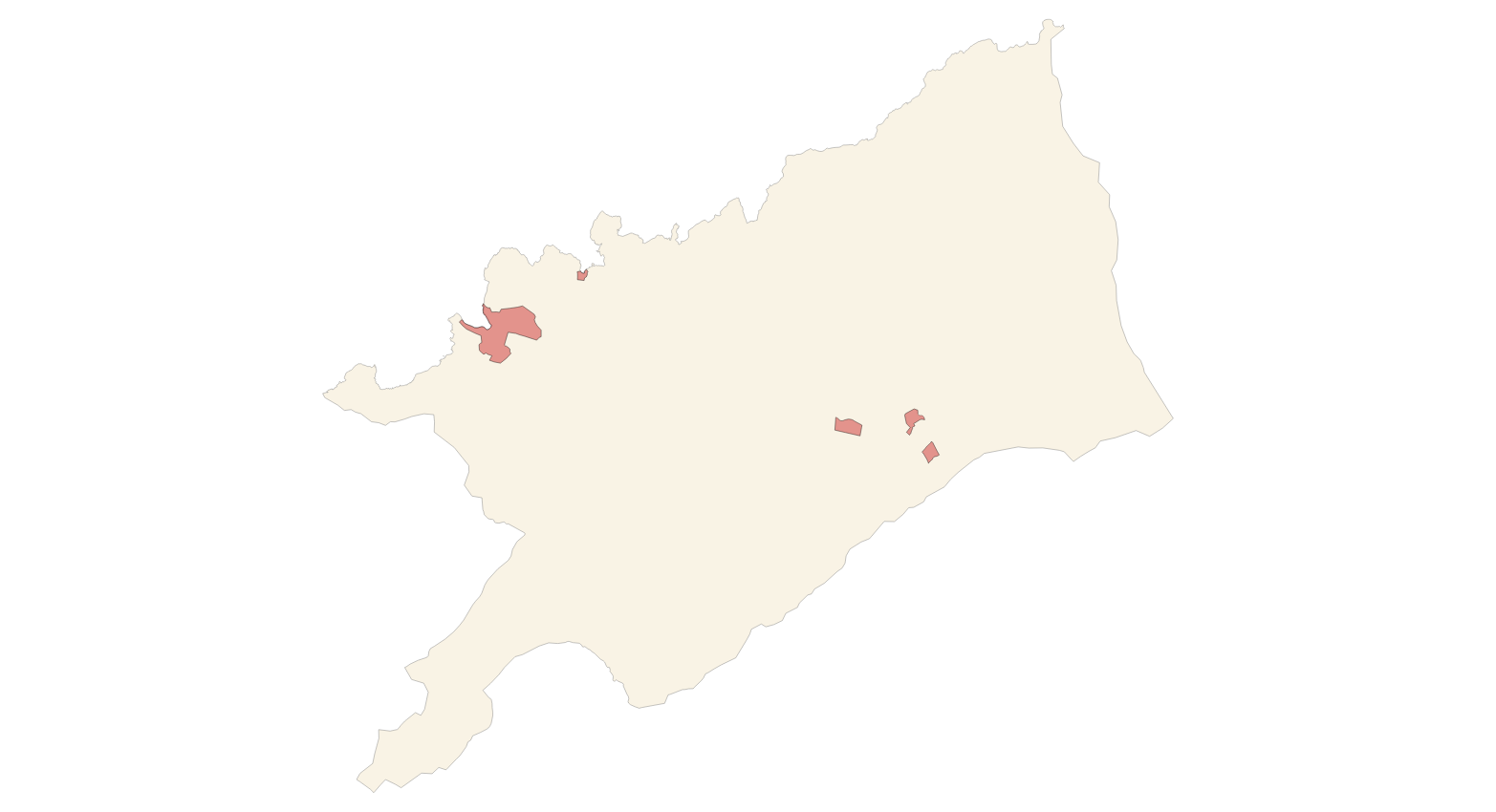
Web Map Service according to the INSPIRE profile of ISO19128 WMS 1.3.0 that allows access to the cartography that represents the transport infrastructure network of Escorca, Mallorca, Balearic Islands Spain. The scale of representation is 1:5000 for the roads and 1:2000 for the streets. Geographic information belonging to the Inspire annex is shown: 1) Transport networks. The layers of information are in accordance with the INSPIRE Directive 2007/2/EC (name, title and style Inspire by default). The access or connection to this service, to obtain the functionalities is free in any case.
-
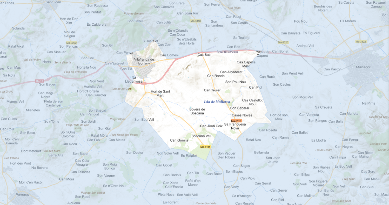
Web Map Service according to the INSPIRE profile of ISO19128 WMS 1.3.0 that allows access to the cartography that represents the transport infrastructure network of Vilafranca de Bonany, Mallorca, Balearic Islands Spain. The scale of representation is 1:5000 for the roads and 1:2000 for the streets. Geographic information belonging to the Inspire annex is shown: 1) Transport networks. The layers of information are in accordance with the INSPIRE Directive 2007/2/EC (name, title and style Inspire by default). The access or connection to this service, to obtain the functionalities is free in any case.
-
Web Map Service that allows access to the cartography of the names Transport networks. You can also check the characteristics of the texts. The associated style of layers is defined by the INSPIRE specifications. Access to this service is free provided that Porreres Town Hall appears as the owner of the data and Consell de Mallorca as the owner of the service.
-
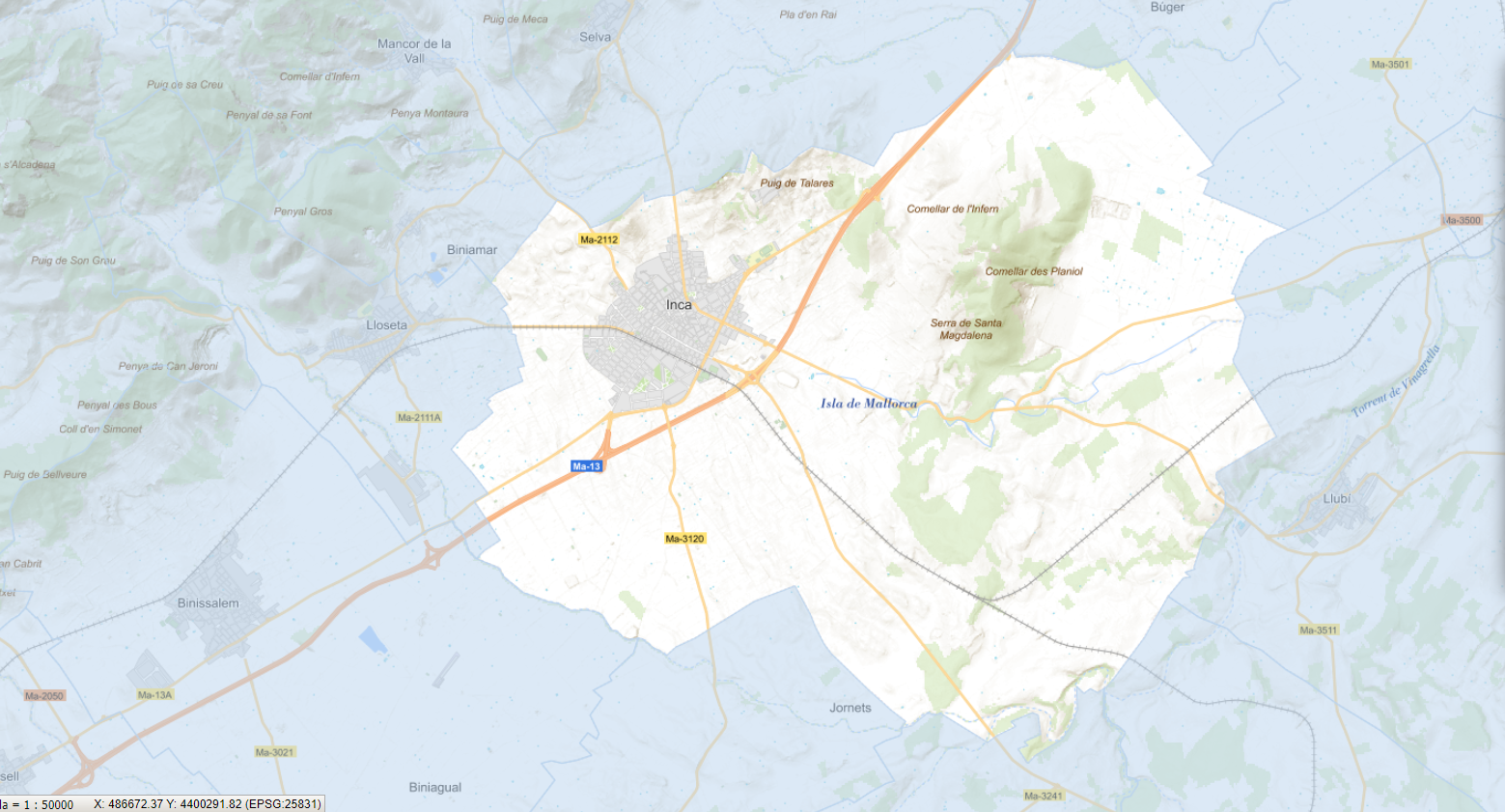
Web Map Service that allows access to the cartography of the species in the urban center of the municipality of Inca. Cartography extracted from the Tree Management Plan of the Urban Center of Inca. The service contains the general layer called SD.SpeciesDistribution contains the vegetable species of the urban center of Inca. The symbology associated with the layers is defined by the INSPIRE specifications. Access to this service is free as long as the Inca City Council appears as the owner of the data and the Consell de Mallorca as the owner of the service. Scale 1: 2,000.
-
Web Map Service that allows access to the cartography of the addresses of the municipality of Ses Salines. Cartography extracted from the Cartociudad project. The service contains the general layer called AD.Addresses.059 contains the addresses of the urban center of Ses Salines and a few kilometers from the rustic area of the municipality. The symbolism associated with layers is defined by the INSPIRE specifications. Access to this service is free provided that Ses Salines Town Hall appears as the owner of the data and Consell de Mallorca as the owner of the service. Scale 1: 2,000.
-
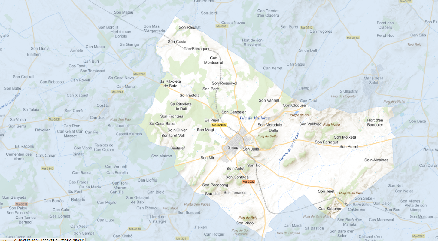
Web Map Service that allows access to the cartography of the addresses of the municipality of Sineu. Cartography extracted from the Cartociudad project. The service contains the general layer called AD.Addresses.025 contains the addresses of the urban center of Sineu and a few kilometers from the rustic area of the municipality. The symbolism associated with layers is defined by the INSPIRE specifications. Access to this service is free provided that Sineu Town Hall appears as the owner of the data and Consell de Mallorca as the owner of the service. Scale 1: 2,000.
-

Web Map Service that allows access to the cartography of the addresses of the municipality of Porreres. Cartography extracted from the Cartociudad project. The service contains the general layer called AD.Addresses.043 contains the addresses of the urban center of Porreres and a few kilometers from the rustic area of the municipality. The symbolism associated with layers is defined by the INSPIRE specifications. Access to this service is free provided that Porreres Town Hall appears as the owner of the data and Consell de Mallorca as the owner of the service. Scale 1: 2,000.
-
Web Map Service that allows access to the cartography of the names Transport networks. You can also check the characteristics of the texts. The associated style of layers is defined by the INSPIRE specifications. Access to this service is free provided that Ses Salines Town Hall appears as the owner of the data and Consell de Mallorca as the owner of the service.
-
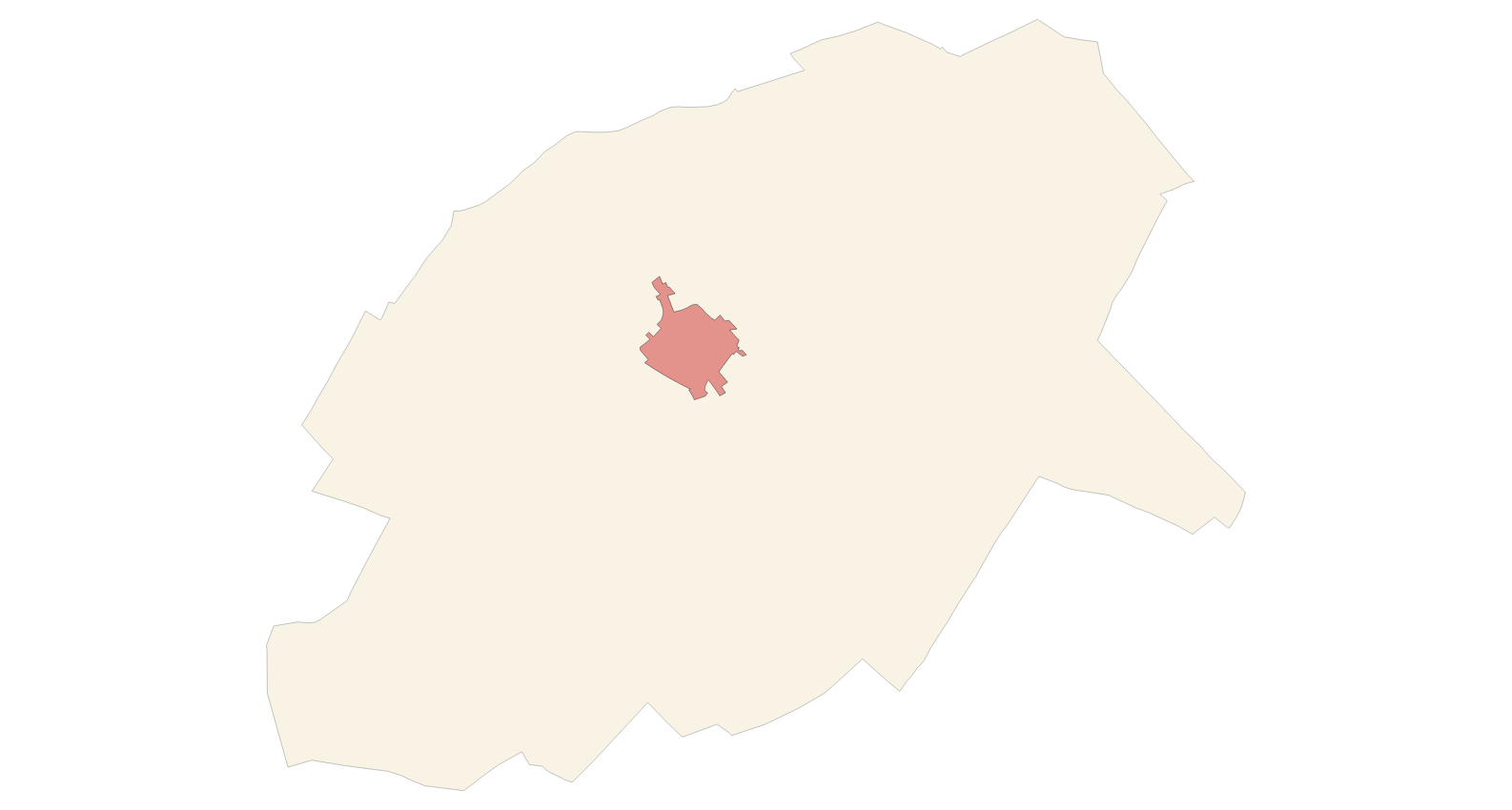
Web Map Service according to the INSPIRE profile of ISO19128 WMS 1.3.0 that allows access to the cartography that represents the transport infrastructure network of Deià, Mallorca, Balearic Islands Spain. The scale of representation is 1:5000 for the roads and 1:2000 for the streets. Geographic information belonging to the Inspire annex is shown: 1) Transport networks. The layers of information are in accordance with the INSPIRE Directive 2007/2/EC (name, title and style Inspire by default). The access or connection to this service, to obtain the functionalities is free in any case.
-
Web Map Service according to the INSPIRE profile of ISO19128 WMS 1.3.0 that allows access to the cartography that represents the transport infrastructure network of Ses Salines, Mallorca, Balearic Islands Spain. The scale of representation is 1:5000 for the roads and 1:2000 for the streets. Geographic information belonging to the Inspire annex is shown: 1) Transport networks. The layers of information are in accordance with the INSPIRE Directive 2007/2/EC (name, title and style Inspire by default). The access or connection to this service, to obtain the functionalities is free in any case.