 Catàleg local de Mallorca
Protected sites
Type of resources
Available actions
Municipios
INSPIRE themes
Keywords
Contact for the resource
Provided by
Years
Formats
Representation types
Service types
Scale
-
Data set containing elements and areas protected by municipal legislation. The protection is provided by the Heritage Catalogue in 2016. The Protected layer. Sites recognize all protected elements (deposits, urban elements, rustic elements, natural areas, etc.). Urban elements are digitized at 1: 1,000 scale and rustic elements, at 1: 5,000 scale. The reference system: ETRS89. Projection system: UTM fus 31. Storage format: PostgreSQL.
-
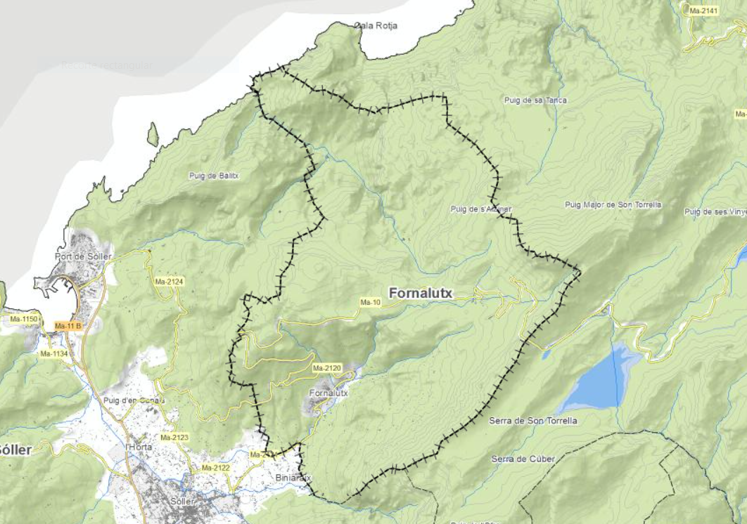
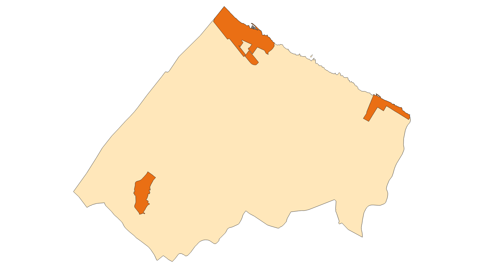
Data set containing elements and areas protected by municipal legislation. The protection is provided by the Subsidiary Regulations of the municipality of Fornalutx in 2006. The Protected layer. Sites recognize all protected elements (deposits, mills, possessions, natural areas, etc.). Urban elements are digitized at 1: 1,000 scale and rustic elements, at 1: 5,000 scale. The reference system: ETRS89. Projection system: UTM fus 31. Storage format: PostgreSQL.
-
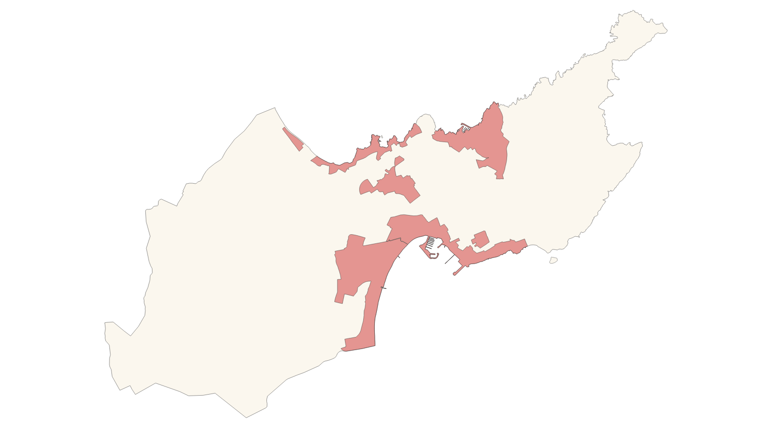
Data set containing elements and areas protected by municipal legislation. The protection is provided by the Subsidiary Regulations of the municipality of Alcúdia in 2002. The Protected layer. Sites recognize all protected elements (deposits, mills, possessions, natural areas, etc.). We also find several layers according to the type of Designation, Scheme of Designation and Protection Classification. Urban elements are digitized at 1: 1,000 scale and rustic elements, at 1: 5,000 scale. The reference system: ETRS89. Projection system: UTM fus 31. Storage format: PostgreSQL.
-
Data set containing elements and areas protected by municipal legislation. The protection is provided by the Subsidiary Regulations of the municipality of Alaró in 2003. The Protected layer. Sites recognize all protected elements (deposits, mills, possessions, natural areas, etc.). We also find several layers according to the type of Designation, Scheme of Designation and Protection Classification. Urban elements are digitized at 1: 1,000 scale and rustic elements, at 1: 5,000 scale. The reference system: ETRS89. Projection system: UTM fus 31. Storage format: PostgreSQL.
-
Data set containing elements and areas protected by municipal legislation. The protection is provided by the Revision of the Subsidiary Regulations of the municipality of Sant Joan in 2016 and the Heritage Catalogue in 2013. The Protected layer. Sites recognize all protected elements (deposits, urban elements, rustic elements, natural areas, etc.). Urban elements are digitized at 1: 1,000 scale and rustic elements, at 1: 5,000 scale. The reference system: ETRS89. Projection system: UTM fus 31. Storage format: PostgreSQL.
-
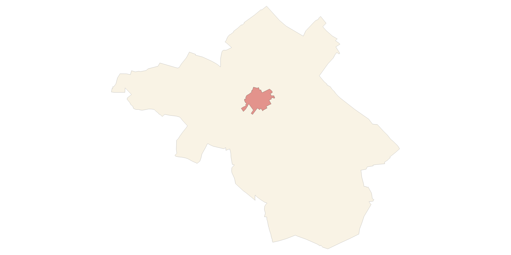
Data set containing elements and areas protected by municipal legislation. The protection is provided by the Heritage Catalogue in 2012. The Protected layer. Sites recognize all protected elements (deposits, urban elements, rustic elements, natural areas, etc.). Urban elements are digitized at 1: 1,000 scale and rustic elements, at 1: 5,000 scale. The reference system: ETRS89. Projection system: UTM fus 31. Storage format: PostgreSQL.
-
Data set containing elements and areas protected by municipal legislation. The protection is provided by the Subsidiary Regulations of the municipality of Marratxí in 1999. The Protected.Sites layer recognize all protected elements (deposits, mills, possessions, natural areas, etc.). Urban elements are digitized at 1: 1,000 scale and rustic elements, at 1: 5,000 scale. The reference system: ETRS89. Projection system: UTM fus 31. Storage format: PostgreSQL.
-
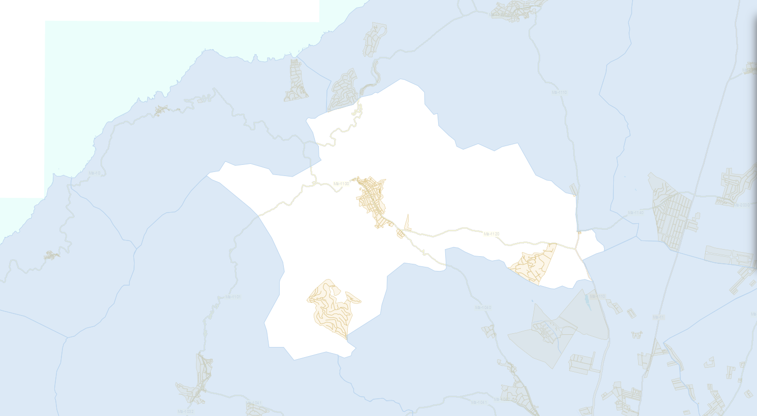
Areas of possible erosion risk according to the 2003 PGOU de Muro Review. Map scale 1: 25,000. Reference system of the ETRS89 file, axle 31 (EPSG: 25831). Original format dwg i pdf. The PGOU de Muro is the integral planning tool of the municipal territory, defines the basic elements of the general and organic structure of the territory; classifies and classifies the soil, establishes the legal regime of classes and categories, determines the permissible uses in the soil and the intensity in which they can be developed, and establishes the program of action for the development of their forecasts. The PGOU de Muro of 2003 was drafted to implement Royal Decree 2159/1978 of June 23, which approved the Regulation of Planning for the development and application of the Law on Soil Regime and Urban Planning.
-
Data set containing elements and areas protected by municipal legislation. The protection is provided by the Subsidiary Regulations of the municipality of Muro in 2003. The Protected layer. Sites recognize all protected elements (deposits, mills, possessions, natural areas, etc.). We also find several layers according to the type of Designation, Scheme of Designation and Protection Classification. Urban elements are digitized at 1: 1,000 scale and rustic elements, at 1: 5,000 scale. The reference system: ETRS89. Projection system: UTM fus 31. Storage format: PostgreSQL.
-
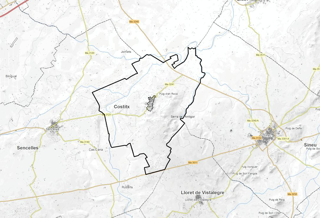
Data set containing elements and areas protected by municipal legislation. The protection is provided by the Subsidiary Regulations of the municipality of Costitx in 2017. The Protected layer. Sites recognize all protected elements (deposits, mills, possessions, natural areas, etc.). We also find several layers according to the type of Designation, Scheme of Designation and Protection Classification. Urban elements are digitized at 1: 1,000 scale and rustic elements, at 1: 5,000 scale. The reference system: ETRS89. Projection system: UTM fus 31. Storage format: PostgreSQL.