 Catàleg local de Mallorca
Geographical names
Type of resources
Available actions
Municipios
INSPIRE themes
Keywords
Contact for the resource
Provided by
Years
Formats
Representation types
Service types
Scale
-
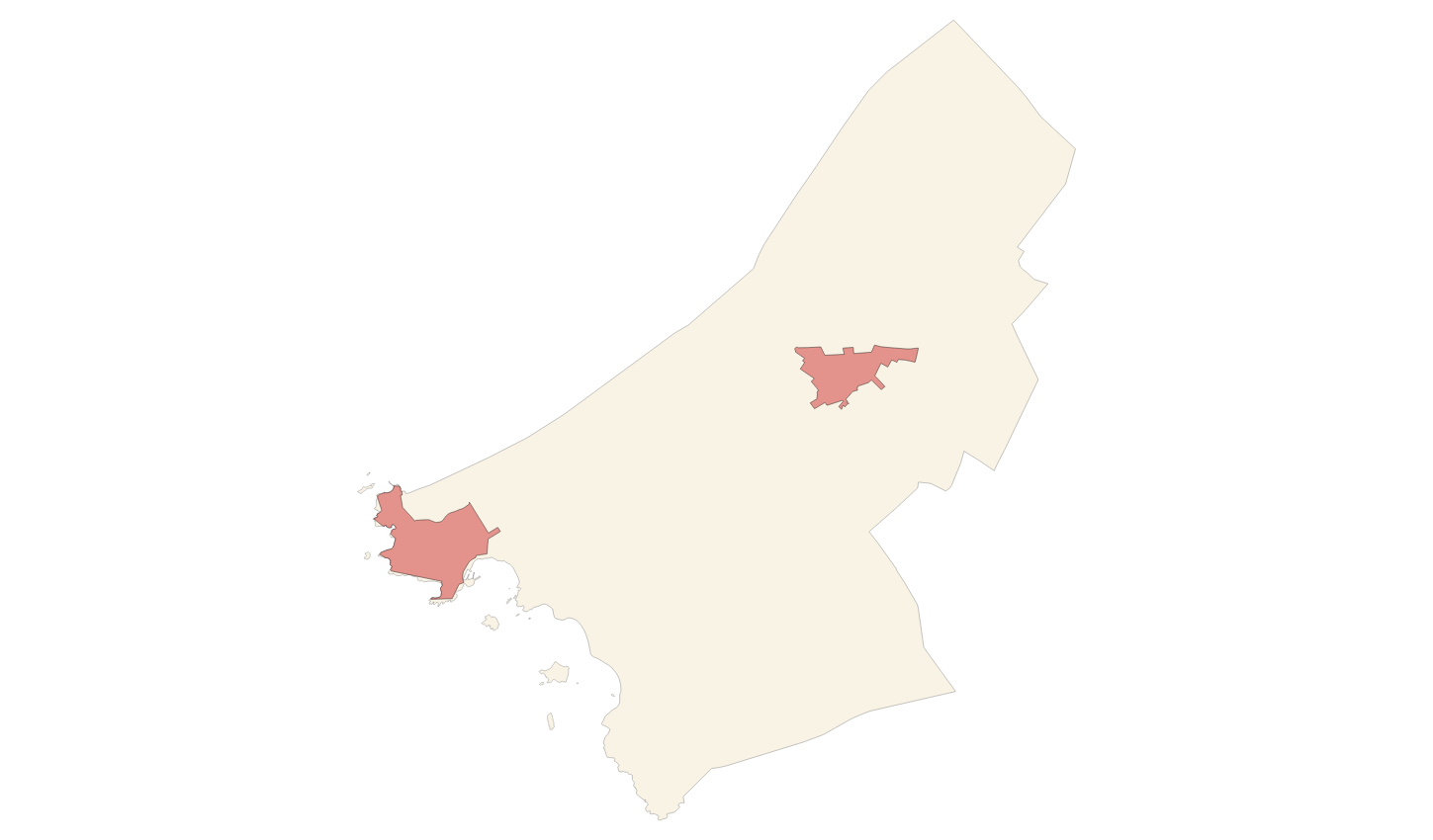
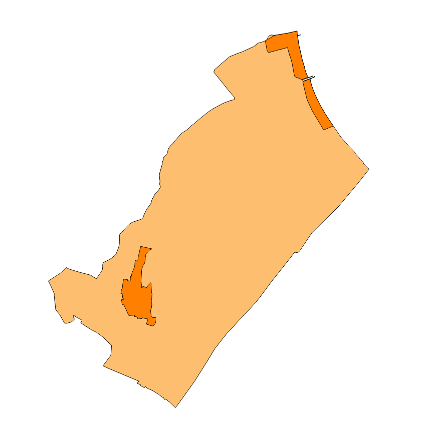
Cartography of the toponymy of the municipality of Ses Salines. The names refer to the topics of the INSPIRE Transport Network in Annex I of the INSPIRE Directive. Cartography generated in 2024. The sources are the Cartociudad project, version 2012, for the names of Transport. The names of the urban elements are at scale 1: 2,000 and the names of the rustic elements, at a scale of 1: 5,000. Reference system: ETRS89. Projection system: UTM fus 31. Storage format: PostgreSQL.
-
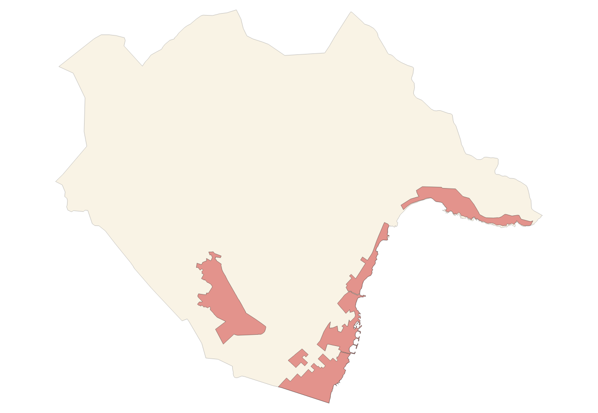
Cartography of the toponymy of the municipality of Sóller. The names refer to the topics of the INSPIRE Transport Network in Annex I of the INSPIRE Directive. Cartography generated in 2024. The sources are the Cartociudad project, version 2012, for the names of Transport. The names of the urban elements are at scale 1: 2,000 and the names of the rustic elements, at a scale of 1: 5,000. Reference system: ETRS89. Projection system: UTM fus 31. Storage format: PostgreSQL.
-
Cartography of the toponymy of the municipality of Son Servera. The names refer to the topics of the INSPIRE Transport Network in Annex I of the INSPIRE Directive. Cartography generated in 2024. The sources are the Cartociudad project, version 2012, for the names of Transport. The names of the urban elements are at scale 1: 2,000 and the names of the rustic elements, at a scale of 1: 5,000. Reference system: ETRS89. Projection system: UTM fus 31. Storage format: PostgreSQL.
-
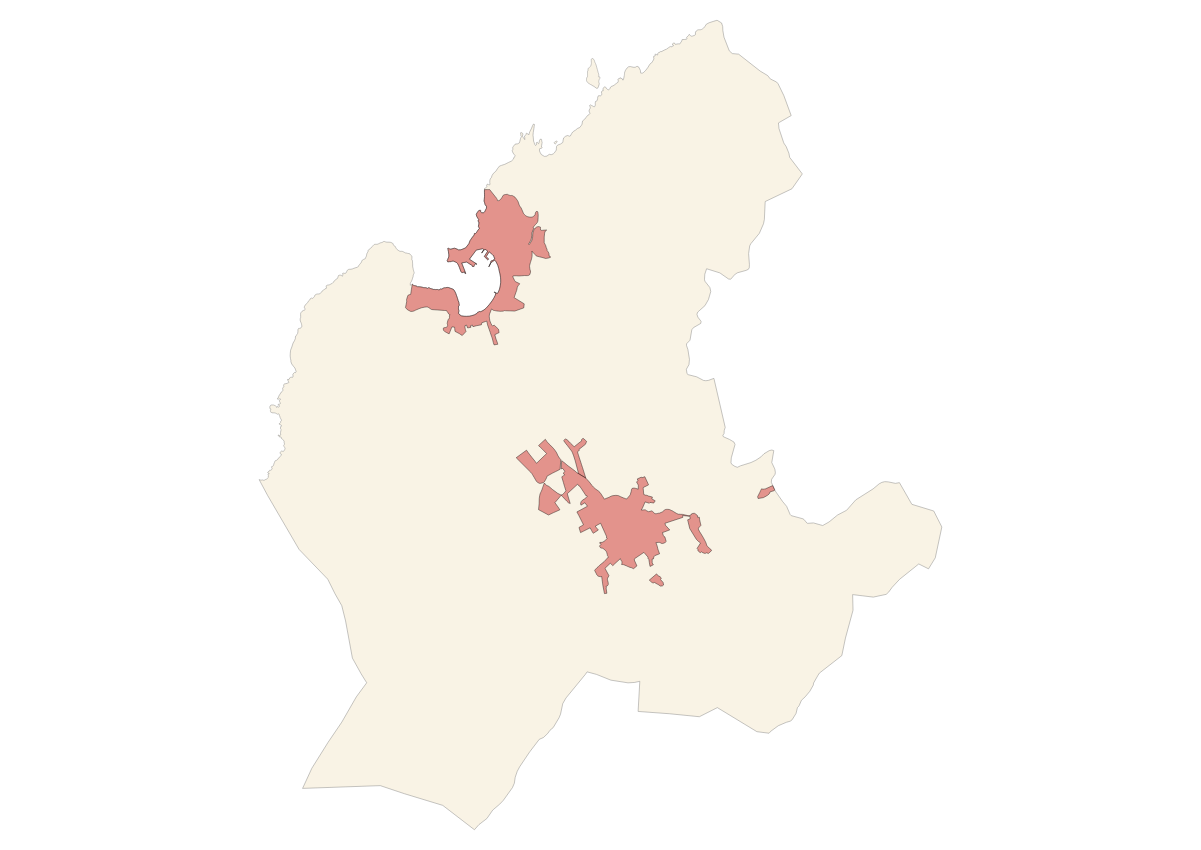
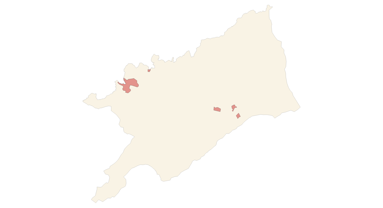
Cartography of the toponymy of the municipality of Fornalutx. The names refer to the topics of the INSPIRE Directive Protected Places, Land use and Transport of Annex I of the INSPIRE Directive. Cartography generated in 2021. The sources are the Fornalutx Subsidiary Rules of 2006 for the names of Protected Places and Land use; the CartoCiudad project, version 2012, for the names of Transports. The names of the urban elements are on a scale of 1: 2,000 and the names of the elements of rustic, on a scale of 1: 5,000. Reference system: ETRS89. Projection system: UTM fus 31. Storage format: PostgreSQL.
-
Cartography of the toponymy of the municipality of Felanitx. The names refer to the topics of the INSPIRE Directive Protected Places and Transport of Annex I of the INSPIRE Directive. Cartography generated in 2015. The sources are the Felanitx Subsidiary Rules for the names of Protected Places and the CartoCiudad project, version 2012, for the names of Transports. The names of the urban elements are on a scale of 1: 2,000 and the names of the elements of rustic, on a scale of 1: 5,000. Reference system: ETRS89. Projection system: UTM fus 31. Storage format: PostgreSQL.
-
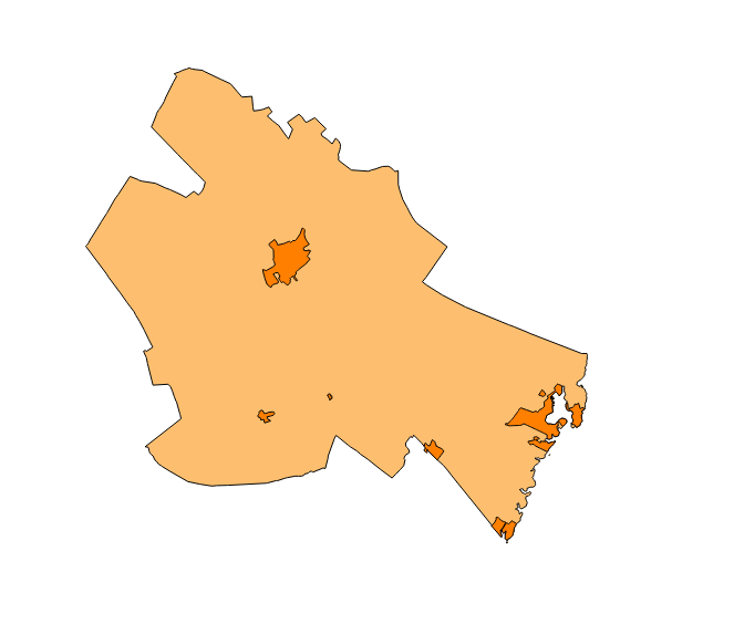
Cartography of the toponymy of the municipality of Porreres. The names refer to the topics of the INSPIRE Transport Network in Annex I of the INSPIRE Directive. Cartography generated in 2024. The sources are the Cartociudad project, version 2012, for the names of Transport. The names of the urban elements are at scale 1: 2,000 and the names of the rustic elements, at a scale of 1: 5,000. Reference system: ETRS89. Projection system: UTM fus 31. Storage format: PostgreSQL.
-
Cartography of the toponymy of the municipality of Escorca. The names refer to the topics of the INSPIRE Transport Network in Annex I of the INSPIRE Directive. Cartography generated in 2024. The sources are the Cartociudad project, version 2012, for the names of Transport. The names of the urban elements are at scale 1: 2,000 and the names of the rustic elements, at a scale of 1: 5,000. Reference system: ETRS89. Projection system: UTM fus 31. Storage format: PostgreSQL.
-
Cartography of the toponymy of the municipality of Muro. The names refer to the topics of the INSPIRE Directive Utility And Governmental Services, Land Use, Protected Sites and Transport Network of the INSPIRE Directive. Cartography generated in 2015. The sources are the Muro Subsidiary Rules of 2006 for the names of Protected Places and Land Use; and the CartoCiudad project, version 2012, for the names of Transports. The names of the urban elements are on a scale of 1: 2,000 and the names of the elements of rustic, on a scale of 1: 5,000. Reference system: ETRS89. Projection system: UTM fus 31. Storage format: PostgreSQL.
-
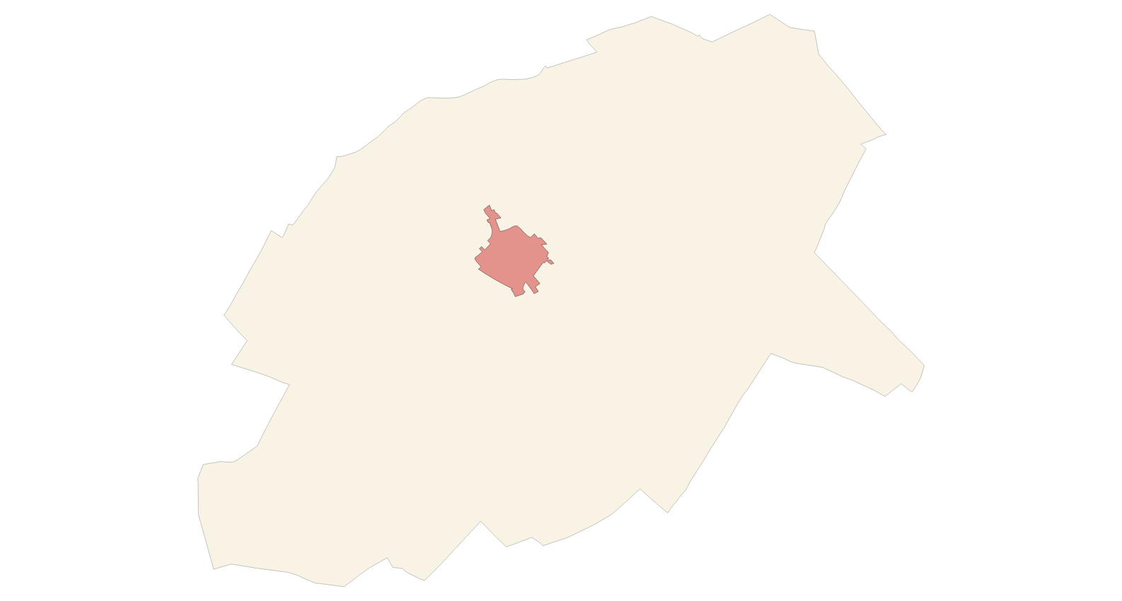
Datset of the toponymy of the town of Bunyola. The names refer to the topics of the INSPIRE Directive Protected Places, Administrative units and Transport network of Annex I of the INSPIRE Directive. Cartography generated in 2015. The names of the urban elements are on a scale of 1: 2,000 and the names of the elements of rustic, on a scale of 1: 5,000. Reference system: ETRS89. Projection system: UTM fus 31. Storage format: PostgreSQL.
-
Cartography of the toponymy of the municipality of Esporles. The names refer to the topics of the INSPIRE Transport and Protected Sites Directive in Annex I of the INSPIRE Directive and Land Uses in Annex III. Cartography generated in 2021. The sources are the Cartociudad project, version 2012, for the names of Transport, and the Urban Rules of 2002 and the Country Rules of 2001 for the names of Land Use and Protected Sites. The names of the urban elements are at scale 1: 2,000 and the names of the rustic elements, at a scale of 1: 5,000. Reference system: ETRS89. Projection system: UTM fus 31. Storage format: PostgreSQL.